Day 7- Lake Superior Circle Tour: Thunder Bay to Nipigon
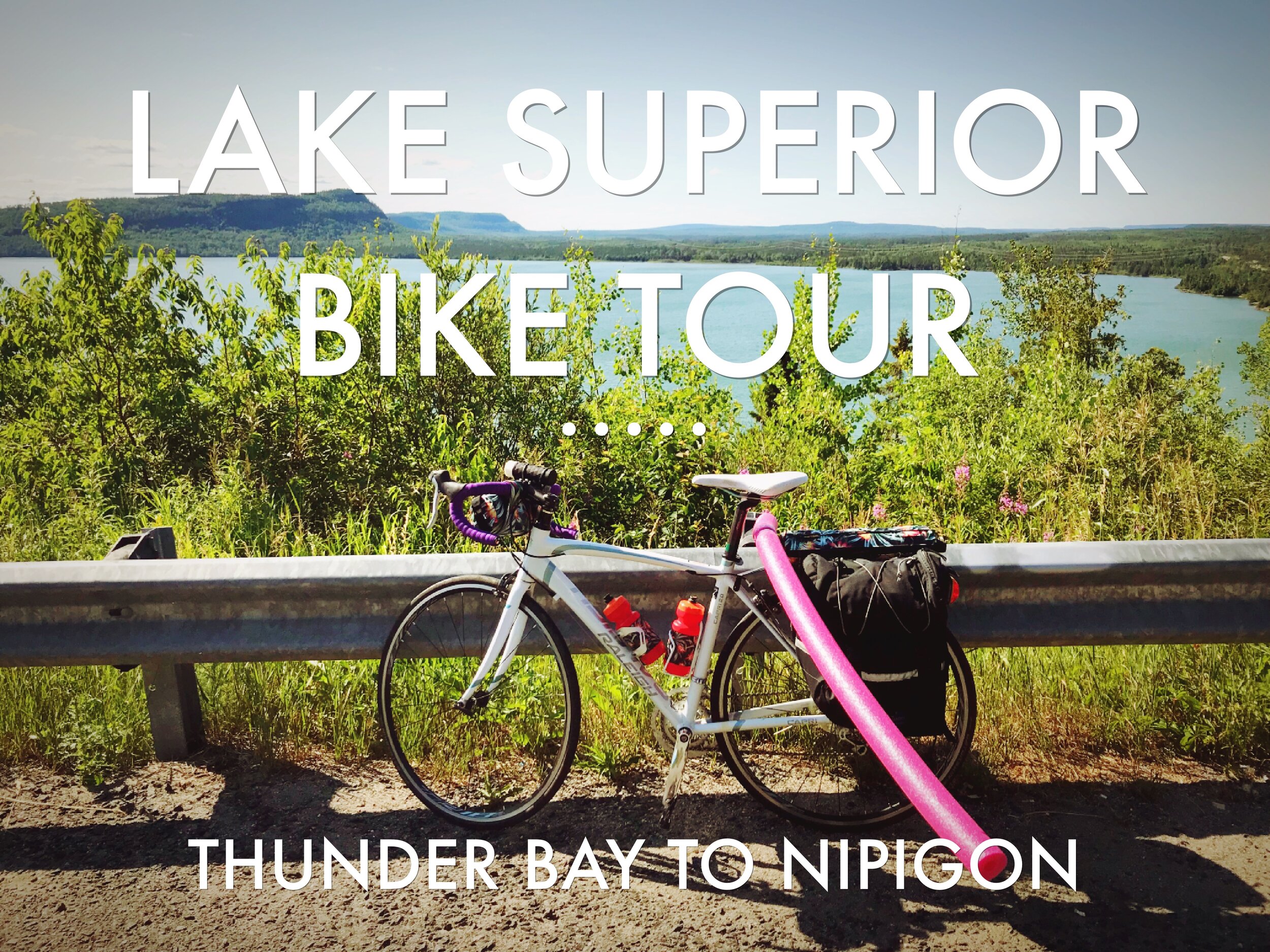
Day 7
Day 7 of our Lake Superior Bike Tour was our longest planned day—over 90 miles! Fortunately after a day of rest in Thunder Bay, we were ready for it. With our brand new Marmot tent that we could actually sit up in our panniers, we headed out of Thunder Bay.
In the cool early morning, we biked out of the city on Lake Shore Drive. Our Warmshowers host, Tim, rode the first 20 miles out of Thunder Bay with us. It was extremely helpful, because he knew the best route out of town, and we didn’t have to keep stopping to look at the map. Tim is a fast cyclist and in his company we put 20 miles behind us before 9:00.

Biking out of Thunder Bay with Tim our Warmshowers host.

This was the longest day we had planned for our Lake Superior Bike Tour yet, and it would prove to be the most stressful.
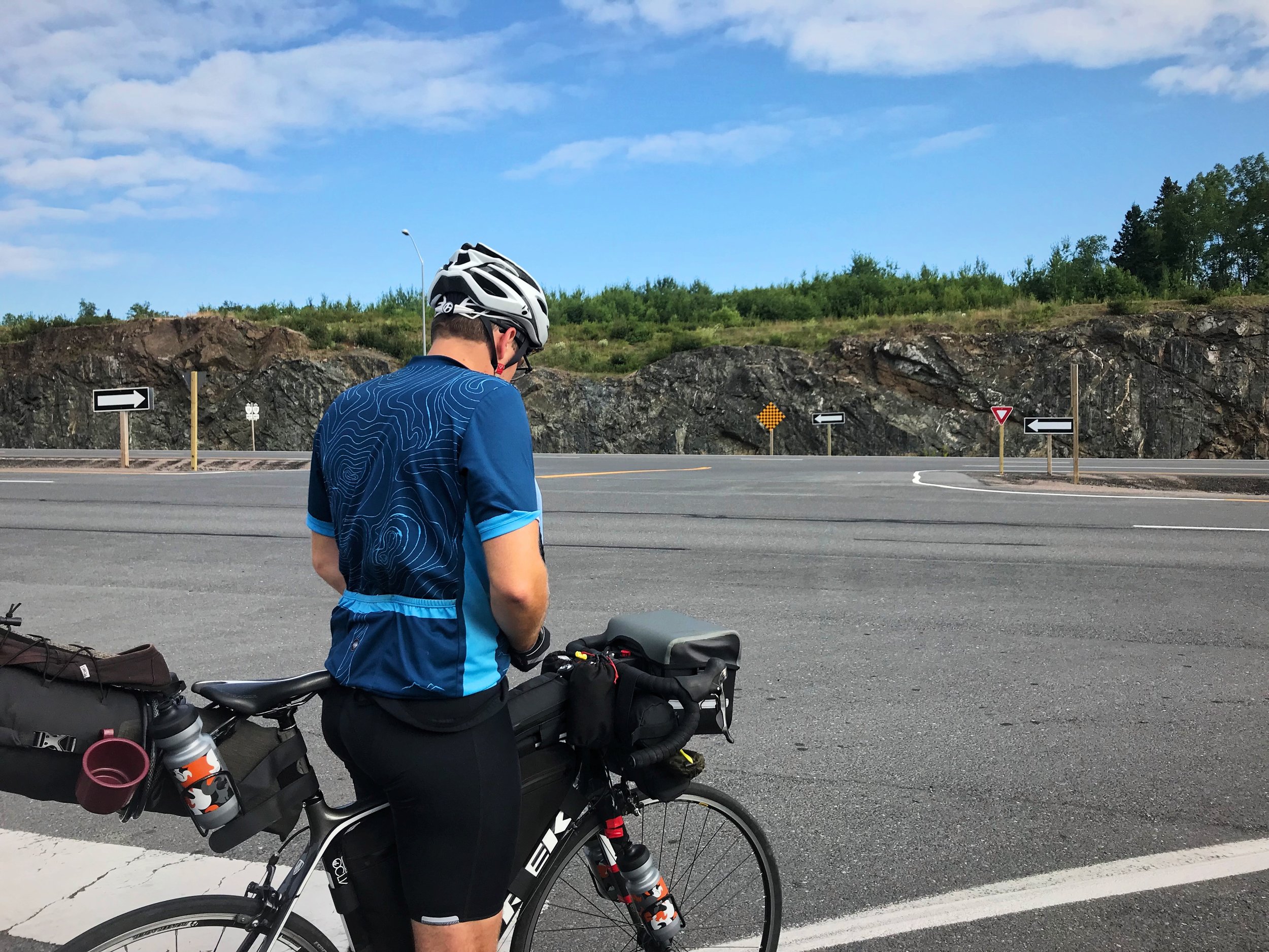
The Trans-Canada Highway
Tim left us at the intersection of Highway 17—the Trans-Canada Highway. The Trans-Canada is a busy commercial trucking route that crosses the entire North American Continent. This is the treacherous road that we would be riding on until we entered the US again. It makes navigating while bike touring really easy though. As Siri would say, “Continue on Highway 17 for 664 kilometers.”
The first section of the Trans-Canada Highway had been recently rebuilt. It’s a four-lane divided highway with a wide shoulder. It feels very weird to bike on a divided highway with cars driving by at 80 mph or faster, but in reality, this stretch with its wide shoulder is really not that bad.

The start of the Trans-Canada Highway, which we would ride on for nearly 700 km.
Getting ready to bike for the first time on the Trans-Canada Highway outside Thunder Bay.
Although this section of the Trans-Canada outside Thunder Bay has four-lanes, the shoulder is very wide, so it’s really not that bad for bike touring.
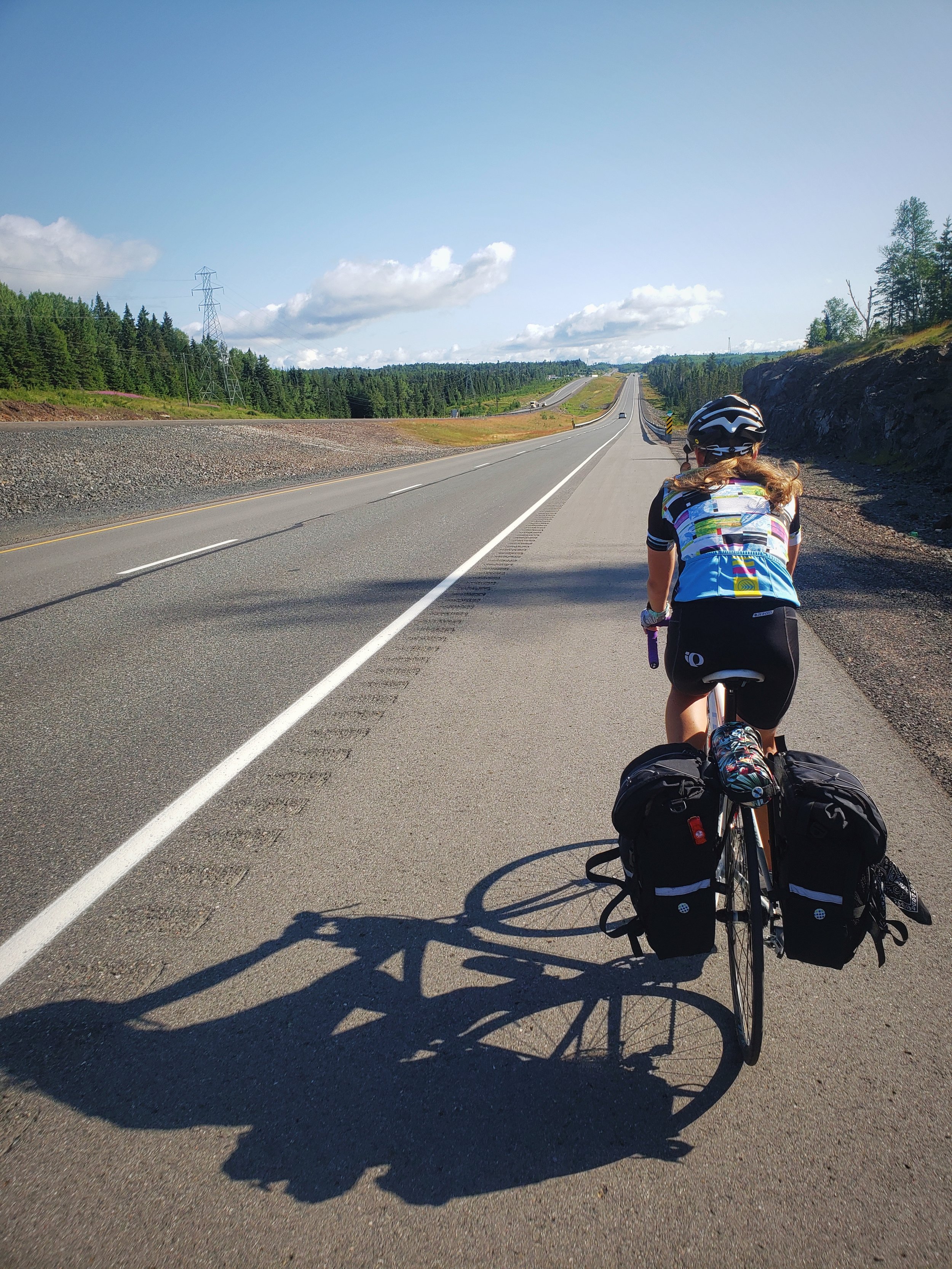
You’ll only get to “enjoy” riding on the divided highway for about five miles, at which point Highway 17 turns into a two-lane road with literally no shoulder to bike on. And we truly mean there is no shoulder. There’s the white line and then gravel. We had read from other cyclists that this stretch was bad, but we didn’t know it would be this awful.
This was the worst stretch of road on the entire Lake Superior Bike Tour.

Biking from Thunder Bay to Nipigon is a nightmare.

These red cliffs outside Nipigon would have been beautiful, but we were exhausted and mentally broken by the time we reached this point.

Ian trying to scroll through Google Maps satellite imagery to see if we would get a shoulder any time soon.
From Thunder Bay to Nipigon the road is extra busy because all the traffic from Highway 11 and Highway 17 is funneled onto this stretch of the Highway. The cars either wouldn’t or couldn’t get over when passing, even though it’s Canadian Law that drivers responsibly pass at a safe distance of a meter.
Every time a semi-truck would pass, we would just give up on being on the road, and we would bail off onto the gravel. We used our helmet mirrors to watch for the trucks rumbling up from behind. At one point we just gave up entirely and tried to ride with our loaded road bikes in the loose gravel of the shoulder. It was so bad that at one point we considered flagging someone down to give us a ride into Nipigon.
I wish I could provide more information about the 70 miles from Thunder Bay to Nipigon, but I think I was blinded by the stress. The highway is far from the lake, and I mostly just remember it as hot and dusty with a few big hills. Shortly before Nipigon, the highway divides again, but there is no nice wide shoulder.

If you’re going to take on the Lake Superior Circle Tour by bike, take a bike with wider tires so that you can ride on the gravel shoulder of the Trans-Canada Highway.
Nipigon, ON
With a death grip on our handlebars, we finally we made it into Nipigon. At the brightly colored visitor center, we got our Lake Superior Circle Tour passport stamped. We asked the bored teenage attendant whether the shoulder got wider heading east from Nipigon, but all we got for an answer was a confused shrug.
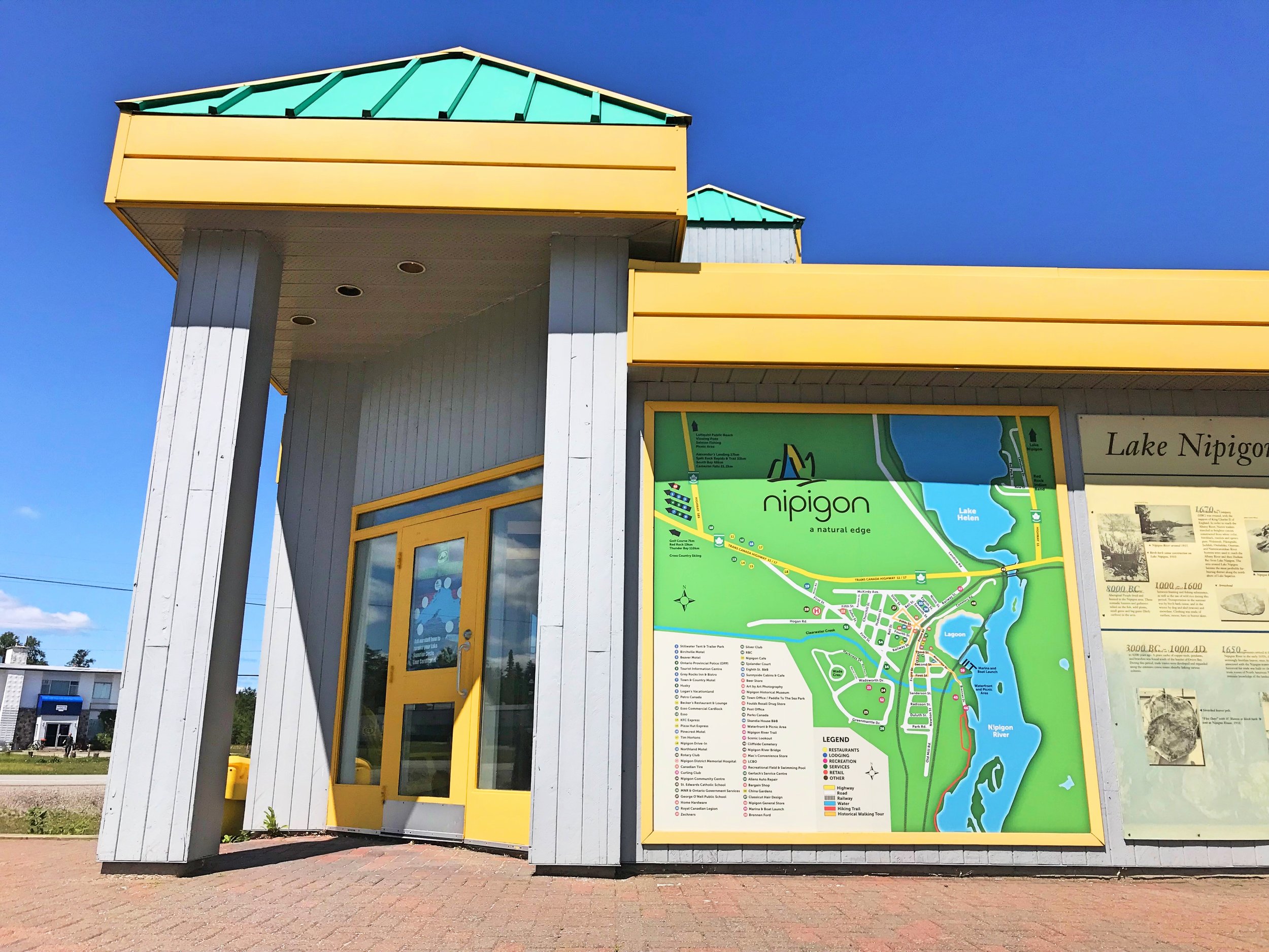
The ridiculously colorful visitor center in Nipigon, Ontario.
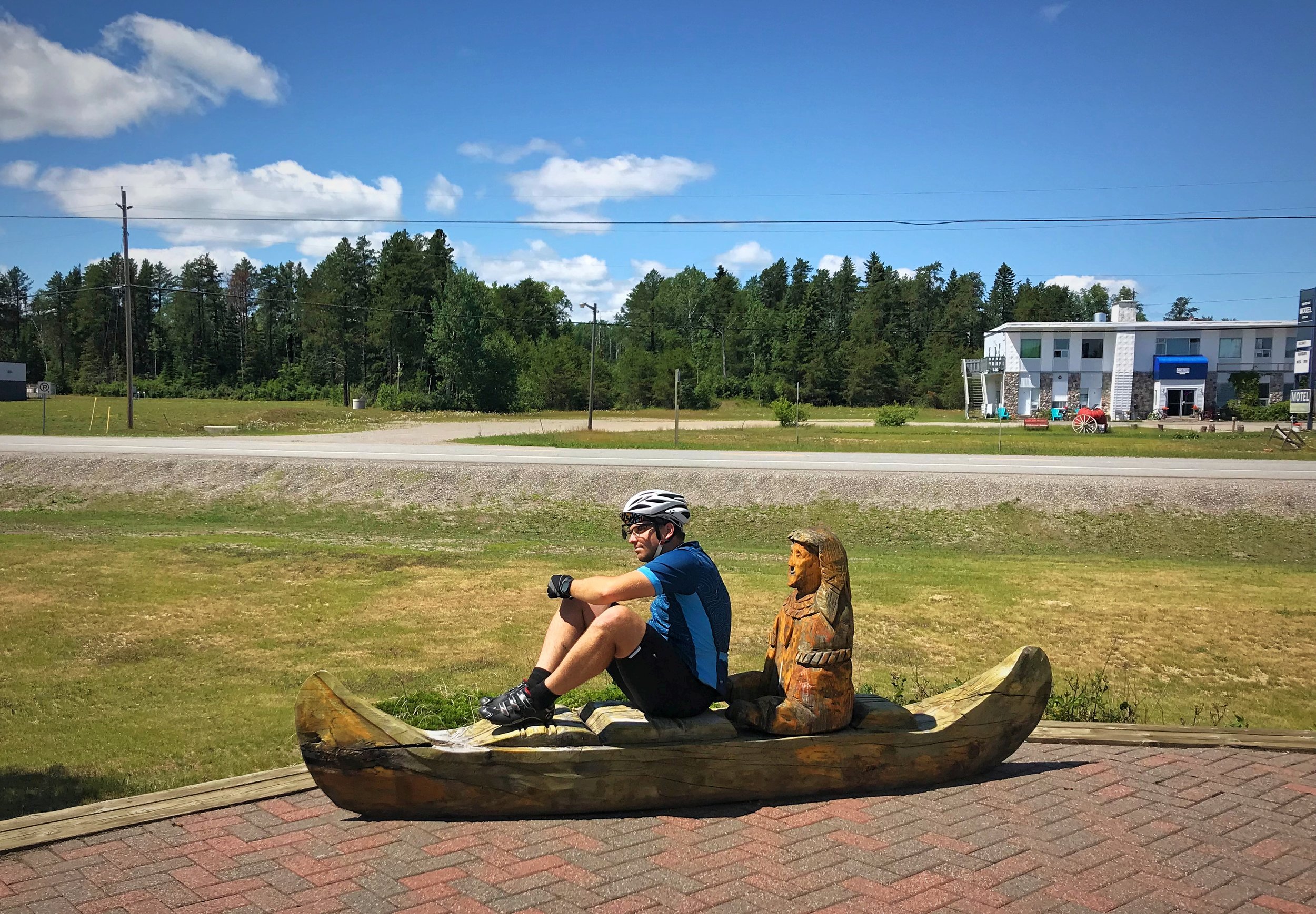
Nipigon is famous for being the starting point of the famous children’s book Paddle-to-the-Sea.
Next we headed to Paddle-to-the-Sea Park in the middle of town. Holling C. Holling’s award-winning children’s book Paddle-to-the-Sea tells of the adventure of a small wooden canoe carved by a First Nations boy in Nipigon. The paddler was launched from the Nipigon River and floats south to Thunder Bay and Duluth, to the Apostle Islands near where we started our Lake Superior Bike Tour, eventually floating through the Great Lakes and the St. Lawrence Seaway. Finally Paddle-to-the-Sea reaches the Atlantic Ocean.

Once we reached Nipigon, we finally got the chance to breathe and rest.

We were very committed to getting our Lake Superior Circle Tour Passport stamped at every point around the Lake.
In Paddle-to-the-Sea Park, there is a giant replica of Paddle-to-the-Sea to honor the book’s origins. Quotes from the books are presented in Ojibwe, French, and English. There is also a pleasantly shady pavilion where we ate lunch, a fountain, and splash pad where kids can play.

Paddle-to-the-Sea Park is a nice place to stop for lunch.
We had tired legs after a morning of biking on and off of gravel on the Trans-Canada.

Paddle-to-the-Sea and Pedal-around-the-Sea.
Just down the street from the park was a Bargain Shop, where we bought a pool noodle. Why would you need a pool noodle on a bike tour, you ask? For protection, of course! We zip tied that bad boy to my bike rack, and voila! A bright pink indicator of the 1-meter distance for drivers to safely pass cyclists!
You can buy something similar on Amazon—a more permanent fold-down flag that you can use to dictate the legal and safe passing space for cars. Or just improvise part way through your bike tour.

Pool Noodles—an essential part of a safe bike tour around Lake Superior.
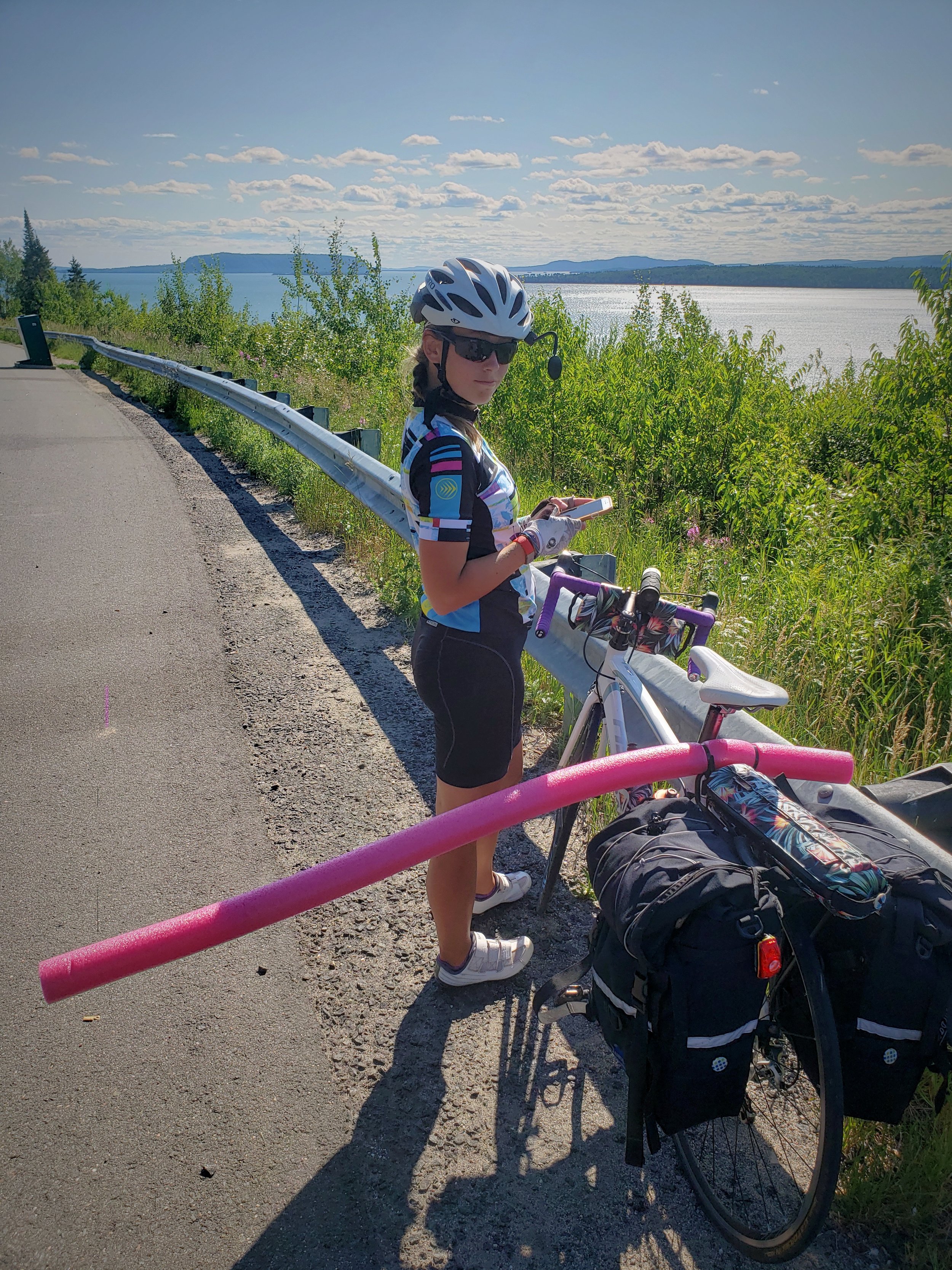
The pool noodle actually did seem to make the traffic on the Trans-Canada pass us at a safer distance.
Before leaving Nipigon, we went to the very strange Bridgeview Lookout Tower. It looks like half of a suspension bridge with Nipigon written in giant letters on the bottom. The view from the top looks out over the mouth of the Nipigon River flowing into Nipigon Bay.

What is this Nipigon? Why do you have this?
The view of the mouth of the Nipigon River from the top of the Bridgeview Lookout Tower.
From the Bridgeview Lookout Tower, you can also see an actual suspension bridge, the Nipigon River Bridge, which we used to leave town (don’t worry there is a sidewalk you can use to cross.) In Nipigon, Highway 11 splits from Highway 17, so to the east of the city, the road is slightly less busy.

The Nipigon River Bridge, which fortunately has a sidewalk that cyclists can use to cross.
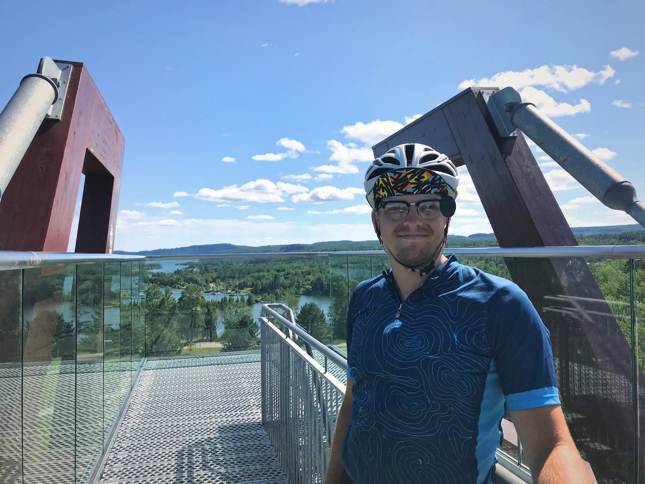
Ian standing at the top of the Bridgeview Lookout Tower in Nipigon, Ontario.
The shoulder is just as narrow, and in many places the road is broken away, so there is even less than a shoulder—a negative shoulder. Fortunately my noodle seemed to be working, and the cars and RVs were giving us a wider berth for the most part. Where cars would previously pass within a foot or two of our bodies, with the noodle they would pass within a foot or two of the end of the noodle.
East of Nipigon, the Lake Superior Circle Tour gets wilder. The woods become denser, and the settlements are fewer. You get closer to the Lake. Even the ground becomes more rugged with bare rock exposed.

After climbing a massive hill east of Nipigon, we were treated to this view of Lake Superior.

Nipigon is the furthest North that you will go on your Lake Superior Circle Tour.
After about 17 miles of cycling and before stopping to camp for the night, we had to get water. We had brought a collapsible bladder to use to carry water to our campsite at the end of the day. We stopped at the Jackpine River to fill our bottles and bladder. We used Aquamira to treat our water on our bike tour around Lake Superior, but this was one of the first times we had to use it, because previously we had been able to get water in cities along our route.

This northern most portion of Lake Superior is dappled with islands and peninsulas.

Ian getting water from the Jackpine River east of Nipigon before camping at Kama Bay Lookout.
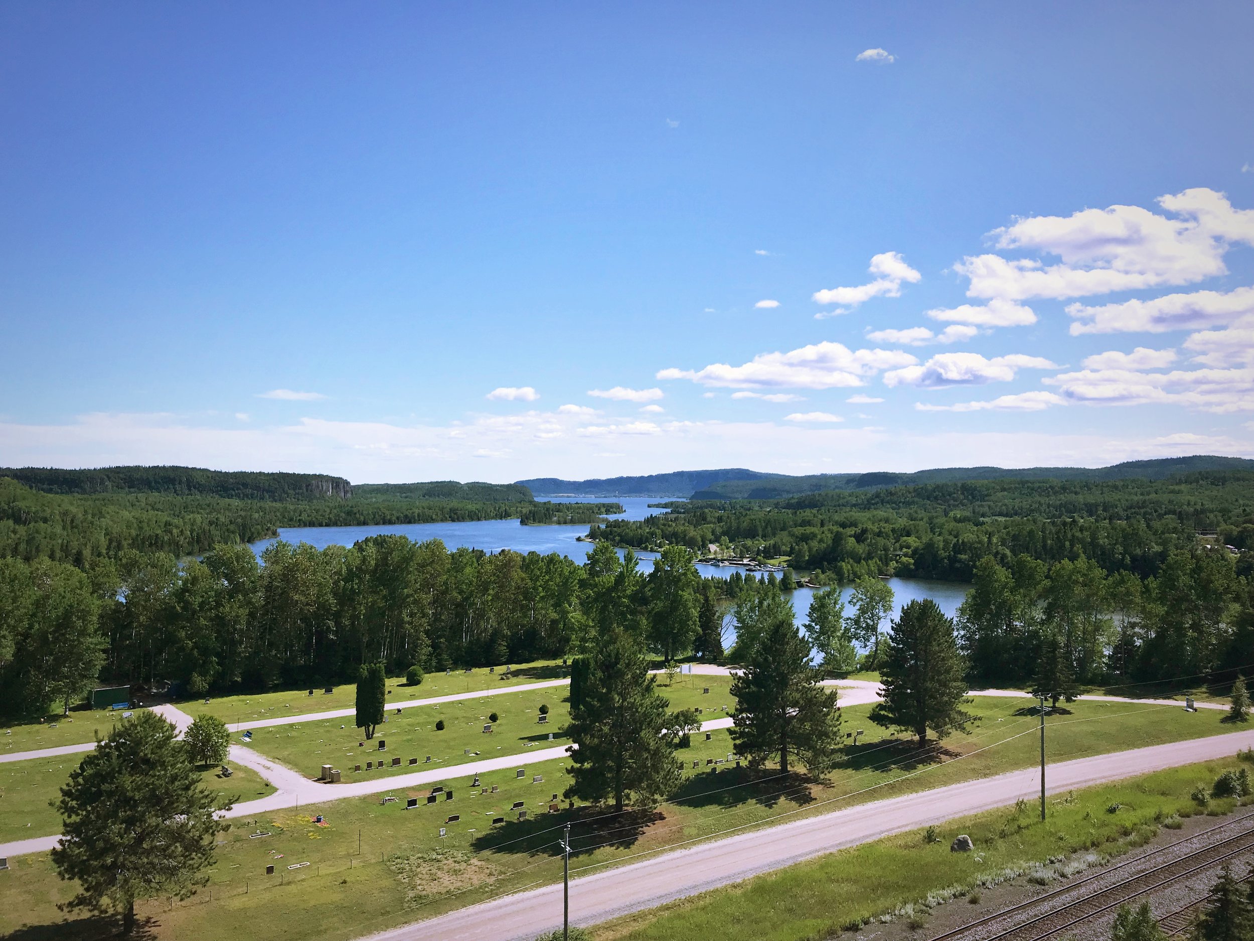
Kama Bay Lookout
The Trans-Canada east of Nipigon has some bigger climbs, and we ended our day by climbing a huge hill. At the top was Kama Bay Lookout, where we camped for the night. It’s listed on Free Campsites, but this is more of a place that camping is tolerated rather than encouraged. In our camper van we would have felt completely comfortable camping there, but it’s a little less stealthy to camp with two loaded bicycles and a tent. Later in the evening, a father and daughter, who were driving across the country, stopped and camped in a tent at Kama Bay Lookout.

The view at Kama Bay Lookout is well worth stopping for, even if you don’t camp here.

Take time to explore the area around Kama Bay Lookout.

Kama Bay Lookout is an excellent place to camp for free on a Lake Superior Circle Tour.
It was very nice to be at a campsite where the grass was mowed, and we could cook with our little camp stove outside at the picnic table without being eaten alive by mosquitoes or horseflies. There was even a pit toilet.
Aside from being a very comfortable camping spot, Kama Bay Lookout is well worth the stop just to see the view. You can walk up to the edge of a sheer cliff and look out at the shimmering aquamarine lake. This is the most northern portion of Lake Superior. The shoreline here lacks definition. It’s hard to tell were the Lake ends and Canada begins. Land and water blend in a series of peninsulas, bays, islands, rivers, and inland lakes. This is the top of the lake.

Views like these are why we decided to bike around Lake Superior in the first place.

We enjoyed being able to cook and eat outside without frantically slapping at mosquitoes at Kama Bay Lookout.
See our full route for Day 7 on Strava!

POSTS ALSO TAGGED:
Bike Mirrors, BIKE ROUTES, BIKE SAFETY, BIKE TOUR PLANNING, BIKE TOURING, BIKING, BRIDGES, Camp Stoves, CAMPING GEAR, CANADA, CITIES, CYCLING GEAR, Free Camping, FRUGAL TRAVEL, Geology, GREAT LAKES, Highway 17, Islands, Jackpine River, Kama Bay Lookout, LAKE SUPERIOR, LAKE SUPERIOR CIRCLE TOUR, Nipigon, NORTH SHORE, ONTARIO, Paddle-to-the-sea, PANNIERS, Provincial Land, PUBLIC LAND, Roadside Attractions, STEALTH CAMPING, TENTS, THUNDER BAY, Trans-Canada Highway, TRAVEL, WARMSHOWERS, Wilderness
How have you biked on the Trans-Canada Highway or done the Lake Superior Circle Tour? Share your experience below!