Day 8- Lake Superior Circle Tour: Nipigon to Terrace Bay

Day 8
I slowly pedaled around the turnaround of Kama Bay Overlook where we had camped the night before, biking just fast enough to that the mosquitos couldn’t keep up. It was the morning of Day 8 of our Lake Superior Bike Tour. It always took Ian longer to pack up his things in the morning. I picked up the pace as a horde of mosquitoes formed around me.

Our free campsite at Kama Bay Overlook on the Lake Superior Circle Tour.
Gravel River, Ontario has the best coffee in town…also the only coffee for miles.
After every item had been meticulously placed in Ian’s saddle bag and frame pack, we headed out onto the Trans-Canada Highway. Each morning of biking on the Trans-Canada Highway began slow when it came to traffic, and traffic only increased as the day went on. Early morning riding on the Trans-Canada might even be called pleasant.

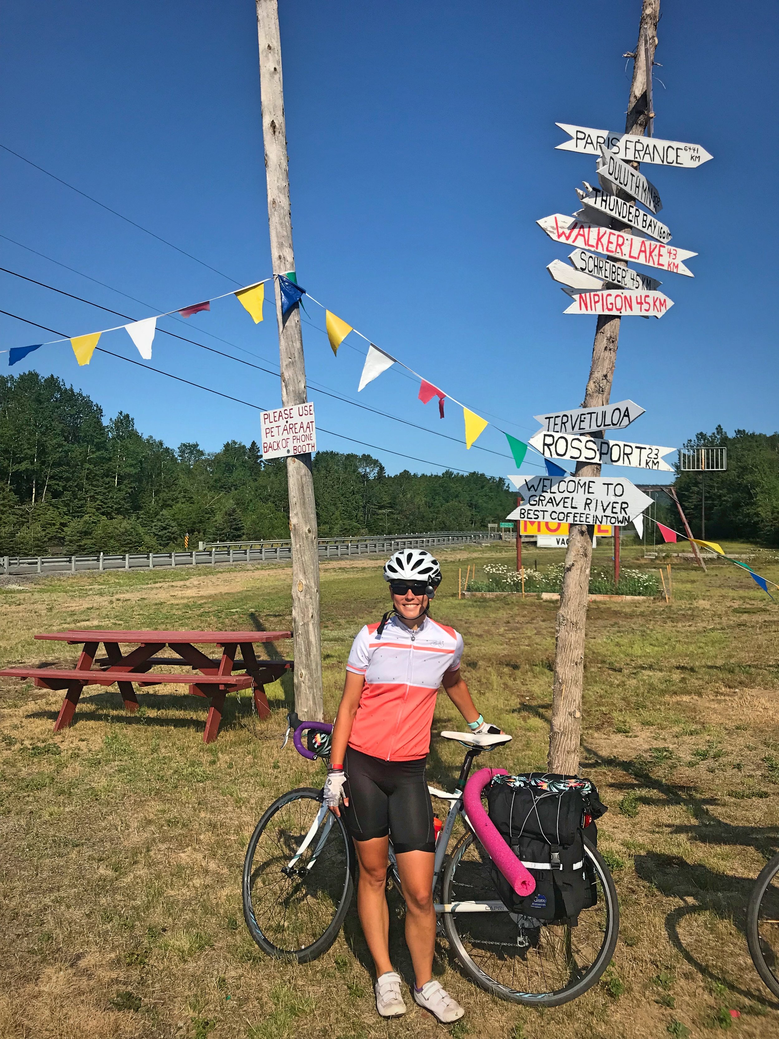
These humorous sign posts were well worth the stop on our Lake Superior bike tour.

Early morning biking before traffic picks up on the Trans-Canada Highway can be pleasant.
At 11 miles, we made our first stop of the morning in Gravel River, Ontario. We stopped at the convenience store and resort. They claim to have “The Best Coffee in Town,” but it’s also the only coffee in town. This tiny settlement is well worth the stop whether you drink coffee or not, just to take a look at the hilarious signposts they have pointed in all directions.
After Gravel River, despite the fact that traffic was increasing, the road did seem to have some areas with better shoulders. Anywhere there is a hill or a twisting turning stretch of road, there is a nice wide shoulder. However the shoulder on the Trans-Canada is always intermittent, and the shoulder will disappear as soon as it starts.

You’re very close to the lake shore when biking from Kama Bay to Gravel River, Ontario.
There were a few major climbs on the Trans-Canada from Nipigon to Terrace Bay, and we hit some major construction as well. We knew construction was coming from reviews of biking around Lake Superior written by others. If you are biking around Lake Superior in summer, you will encounter construction, because in this part of the world there is really only a three-month period for construction.
In the worst pat of the construction was that they had textured the road with linear grooves so that later they could repave. It was extremely difficult to ride on. The way that it rattled our bikes, made it very uncomfortable in our wrists and saddles. The way that the grooved road made our skinny bike tire wobble even made it difficult to control our bikes on the downhills.

This section of the Lake was the inspiration to numerous Canadian artists.

The northern shore of the Lake is lined with numerous islands and shallow bays.
Construction can make roads very unsafe for cycling. In several places, the construction reduced the Trans-Canada Highway to a single lane with flaggers ensuring that traffic was only flowing in one direction. In most places this was actually fine because the flagger would allow us to ride inside the cones. This was better than actually riding on the road—it was like having a private protected bike lane.
However, in one construction zone where traffic was reduced to a single lane, there was no shoulder and a guardrail to prevent us from even getting off the road. We started off with traffic but on this long stretch, they quickly passed us and made it through the one-lane section much faster than us. For some reason, the flaggers let the traffic go in the other direction, even though in Ontario, bicycles have the same rights as cars. All we could do was stop and squeeze as close as we could to the guardrail and wait for all the semis to rumble by only a foot or two away from us.

This was a hot and sunny day. When you’re bike touring, you start developing some very unique tanlines.

Rocky granite are the exposed shoulders of the Canadian Shield, which forms the foundation of the North American Continent.
One trick we learned was to ask the flagger how far the stretch of construction was so that we could mentally prepare for what was in store for us. On this particular day we bike through about 13km straight of torn up road. By the time we reached the First Nations community of Pays Plat, the road was mostly free of construction.
In Pays Plat we added some Canadian-specific foods to our diet—Tim Horton’s Iced Double Doubles and some sort of chips called “Crispers.” We needed to prepare for the serious climbs that were yet to come.

We strapped pool noodles to our bikes to keep cars at a safe distance while passing.

If you are doing the Lake Superior Bike Tour, eat some Canadian junk food—you deserve it!
In Anishinaabemowin this area is named Baagwaashiing which means "Where the water is shallow." But we could understand why the fur traders started calling it Pays Plat, which means “flat land” in French. This community lies on the flat land between two mountains. We descended a steep hill as we came into town, and climbed an even steeper hill as we left.
After Pays Plat we were away from the lake for a few miles, but we arrived back at the shore in Rossport. There is a lovely public beach at the edge of town, so we decided to take a break and go for a swim. The Lake here is shallow and the small bay is protected by a small island, so the water was semi-warm even.

Any time there is a public park and a sunny day, it’s a good opportunity to dry out clothes.

If you go over to the sand bar at the end of the bay, you don’t have to walk on sharp rocks to get into the water.

The icy waters of Lake Superior will make you feel refreshed on a hot July day of bike touring.
This part of the lake is particularly beautiful, because the shore has many islands, which gives it a more intimate feel. At the beach, there was a display about The Group of Seven—a famous group of Canadian artists who were drawn to the landscape of this part of the Lake. Their paintings of rugged wilderness have played a role in defining Canadian art. Some of the most famous paintings of the Lake are from this most northern area of the shore.

If you are biking around Lake Superior, swimming needs to be a critical component of your tour.

Ian wimping out and standing on the rock, psyching himself out before jumping in.
Our steepest climb for the day was not the hill leaving Pays Plat. It was a 1400-foot multi-summit behemoth between Rossport and Schreiber. Along this stretch, if you have time you can also stop at Rainbow Falls Provincial Park ($2/person).
Although we weren’t on the lakeshore for this portion of the ride, there are many small peaceful inland lakes. These lakes were carved out of the land by glaciers. They lakes are surrounded by boreal forest, or taiga, which is dominated by conifers.

The small town of Terrace Bay is one of the last towns for a while, so if you need supplies, buy them here.
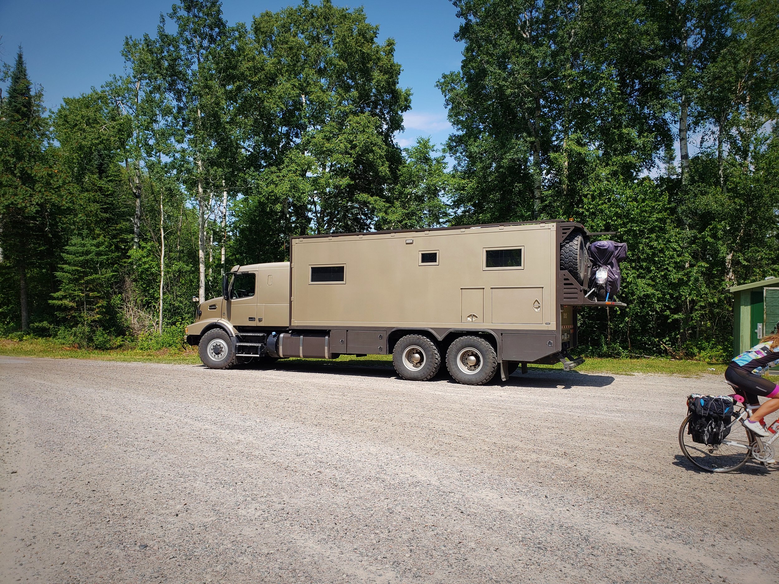
This is the dream “van” for those who want to join the vanlife trend, but have too much money, and not enough sense.
Finally we reached our destination for the night—Terrace Bay. On the outskirts of town, we stopped at Augasabon Falls. The falls tumble over a jagged 110-foot cliff and the water runs through a deep gorge before flowing out into Lake Superior in the distance.
Unbelievably, these falls are actually man-made. They were created in the 1940s as part of water diversion project for hydroelectric power station. The Aguasabon River flows through Hays Lake, which was a enlarged by 500 times as part of the development. After crashing over the cliff, the river follows a crack in the 2.6 billion-year-old bed rock.

Augasabon Falls is only a half mile from the highway, so don’t miss these falls while biking around Lake Superior.

The Aguasabon River flows through a crack in the rocky Canadian Shield.
Once in town we stopped at Terrace Bay Visitor Center to get our Lake Superior Circle Tour Passport stamped. We also paid a visit to the Terrace Bay Lighthouse. The Terrace Bay Lighthouse is a wooden, white, slatted lighthouse. You can climb to the top of this purely decorative lighthouse to get a view of the city and the lake from the top.

The completely decorative, but utterly cute, Terrace Bay Lighthouse.

The “light” at the top of the Terrace Bay Lighthouse—a fun stop on the Lake Superior Circle Tour.
Terrace Bay is a full-service community with restaurants, a grocery store, and an LCBO, which are the state-owned liquor stores in Ontario. You can resupply here if needed. We stopped in to pick up some beer, which we were able to keep cold by putting them in our Stashers insulated bags while we headed down a MASSIVE hill to Terrace Bay Beach.

Being able to drink cold beer at the end of a long day of riding is such a treat.
Eating dinner on Terrace Bay Beach at the end of Day 8 of our Lake Superior Circle Tour.
Not only is Terrace Bay Beach an incredible expanse of blue water and sand, it’s also a free campsite. We felt a bit weird about pitching our tent on the beach at first, but after we saw that some other people were camping, we felt more comfortable. In fact it’s one of our favorite free campsites that we camped on the Lake Superior Circle Tour.

Ian biking back to our campsite on Terrace Bay beach with our General Tsos in tow.
It was a hot day, and I went for my second swim of the day. It’s wonderful to end a day of biking around Lake Superior by camping right on the shore. That way you can end the day with a swim and when you change into your camp clothes, you feel clean. It’s amazing how nice you can feel after rinsing off in the freezing lake.
On Day 8 of our bike tour around Lake Superior we combined two days of planned riding. Despite having taken a day off in Thunder Bay, we were back on track with where we had planned to be on this night.

Patiently awaiting the delivery guy in Terrace Bay.

We probably wouldn’t recommend Wah’s Restaurant, unless you have biked 50+ miles.

The best part about Terrace Bay is that you can camp on the beach.
I stayed down on the beach drinking beer, while Ian biked back up the huge hill into town to pick up some Chinese food from Wah’s Restaurant. I can’t say we’d recommend it, but it still tasted good to us after biking 50 miles.
Our day ended with moody blue clouds rolling into the bay, replacing the previously sunny day. We both slept well on the beach that night, despite the fact that it stormed most of the night.

We ended Day 8 of our Lake Superior Bike Tour by watching a summer storm roll over Terrace Bay. It rained steadily all night.
See our full route on Strava!

POSTS ALSO TAGGED:
Art, AeroTech Designs, Augasabon Falls, Beaches, Beer, Bike Clothing, BIKE ROUTES, BIKE SAFETY, BIKE TOUR PLANNING, BIKE TOURING, BIKING, CANADA, Cheap Eats, Construction, Cycling Gear, Frame Packs, FREE CAMPING, FRUGAL TRAVEL, GEOLOGY, Gravel River, GREAT LAKES, HIstory, HIGHWAY 17, ISLANDS, KAMA BAY LOOKOUT, LAKE SUPERIOR, LAKE SUPERIOR CIRCLE TOUR, Lighthouses, NIPIGON, NORTH SHORE, ONTARIO, Pays Plat, PROVINCIAL LAND, PUBLIC LAND, Rain, ROADSIDE ATTRACTIONS, RossPort, Schreiber, Stashers, TENTS, Terrace Bay, Terrace Bay Beach, Terrace Bay Lighthouse, TRANS-CANADA HIGHWAY, TRAVEL, Waterfalls, WILDERNESS
Have you done the Lake Superior Circle Tour? What were you favorite spots on the Northern Shore?